The Section 368 Energy Corridor Mapping Tool, developed for the Bureau of Land Management (BLM), Department of Energy (DOE), and the U.S. Forest Service (USFS) uses PAD-US data to show protected areas by GAP Status Code (a measure of biodiversity protection). The tool provides geospatial information for designated Section 368 energy corridors in 11 western states, much of which is relevant to corridor routing decisions.
The Energy Policy Act of 2005 (Section 368) required multiple federal agency secretaries to designate energy corridors on federal lands in 11 Western states: Arizona, California, Colorado, Idaho, Montana, Nevada, New Mexico, Oregon, Utah, Washington, and Wyoming. Energy corridors are potential sites for oil, gas and hydrogen pipelines and electricity transmission and distribution facilities (Source: https://www.energy.gov/oe/services/electricity-policy-coordination-and-implementation/transmission-planning/energy).
Multiple conservation groups objected to these plans based on potential impacts to wildlife, habitat, wilderness and other protected areas, and other environmental concerns, leading to a lawsuit and settlement (Source: http://corridoreis.anl.gov/regional-reviews/settlement/). In 2013, the BLM, USFS, and DOE signed a memorandum of understanding, which provided additional guidance for regional reviews of these energy corridors (source: http://corridoreis.anl.gov/documents/docs/S368_Settlement_MOU_Signed_07-08-2013.pdf). Based on regional reviews, agencies can also modify energy corridors.
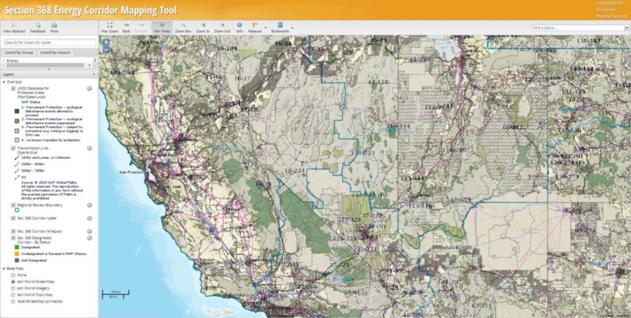
Image Source: https://bogi.evs.anl.gov/section368/portal/