Fighting wildfires requires access to lots of geospatial information, which is used to plan and direct on the ground responses, determine responsibility areas (federal vs. state, etc.), track historical information for analysis, etc. PAD-US data is a crucial part of this information system, providing the ownership and management designation boundaries of federal, state, regional and local parks and other protected areas to anyone working on fire response.
The following resources were particularly active during California’s devastating fires in the San Francisco Bay Area ( 2017 Tubbs and other) and the much more damaging fire in the northern Sacramento Valley foothills (2018 Camp fire) – these fires destroyed over 10,000 homes and resulted in over 100 deaths, with the Camp fire being the deadliest and most destructive wildfire in California’s history.
One key resource is the Department of the Interior’s (DoI) National Wildfire Coordinating Group’s GEOMAC application – hosted by USGS for the DoI Office Wildland Fire, which manages the Group. USGS provided the NWCG with a provisional version of PAD-US 2.0 in June 2018 to prepare for that fire season. This layer viewer provides detailed information on current fire locations and perimeters along with PAD-US and other related data to assist planners during wildland fire response:
“In order to give fire managers near real-time information, fire perimeter data is updated daily based upon input from incident intelligence sources, GPS data, infrared (IR) imagery from fixed wing and satellite platforms. The GeoMAC web site allows users in remote locations to manipulate map information displays, zoom in and out to display fire information at various scales and detail, and print hard copy maps for use in fire information and media briefings, dispatch offices and coordination centers. The fire maps also have relational databases in which the user can display information on individual fires such as name of the fire, current acreage and other fire status information.”

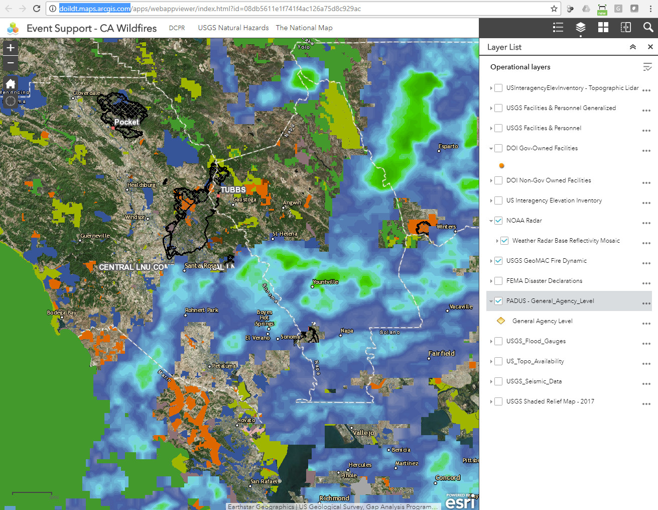
In addition, the U.S. Department of the Interior has created its Landscape Decision Tool (DOILDT), which “provides access to a suite of online web map services such as feature layers, basemaps, and web applications” and is used extensively as a resource for wildfire incident response and analysis. The example below is from a California Wildfire Response application developed with DOILDT GIS tools, based at ArcGIS.com and incorporating a wide range of data layers: