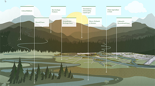
Communities across the U.S. and the world are working to preserve and connect open space, wildlife habitats, parks and other important landscapes, as part of planning for Green Infrastructure.
“The USGS Gap Analysis Project (GAP) has a long history of contributing to the conservation of our Nation’s plant and animal species,” says Ryan Perkl, Esri Green Infrastructure Lead. “Esri is integrating GAP species and the new PAD-US 2.0 data into its Green Infrastructure Initiative, a collection of authoritative data, models, online applications, and other resources aimed at empowering individuals and organizations engaged in local land conservation efforts. USGS GAP species and protected areas data are also highlighted as authoritative data through the ArcGIS Living Atlas of the World, which provides decision makers with robust information related to species distributions and biodiversity.”
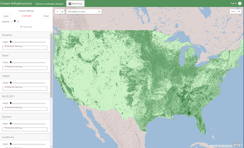
Esri’s online applications allow analysis of Green Infrastructure opportunities, and have connections to PAD-US data like Gap Status Codes: