Taking a Recreational Vehicle out to find a great campsite is an avocation for hundreds of thousands of people in the U.S. One couple has been on the road in their RV for years and has published an app to help find these sites on public lands – PAD-US 2.0 has given them and their app a huge boost in quality.
Chris Dunphy and Cherie Ve Ard run Technomadia, a site dedicated to helping people get to the “boondocks” in a camper or boat and make the best use of mobile internet and other technology to support their journeys. On the road for almost 15 years, the couple developed a series of apps including “US Public Lands“, for both iOS and Android.
US Public Lands has off-line data from PAD-US which overlays on cell-service based location and other base maps information, allowing search and filtering of protected areas data. Chris and Cherie have a great article including very entertaining video about this app and what having PAD-US 2.0 has meant for them now: “Thank you to the Protected Area Database (PAD-US) of the U.S. Geological Survey for providing the public domain raw map data that we’ve been able to utilize to create this interactive overlayable mapping & navigation tool. We will update our maps in the future to stay in sync with improvements to this data set.”
The PAD-US team encourages all app and base map developers to use PAD-US and to learn more about how it can help them in their mapping applications – download the most current Basemap Guidance memo from the Federal Lands Working Group to learn more (see memo listed in right sidebar).
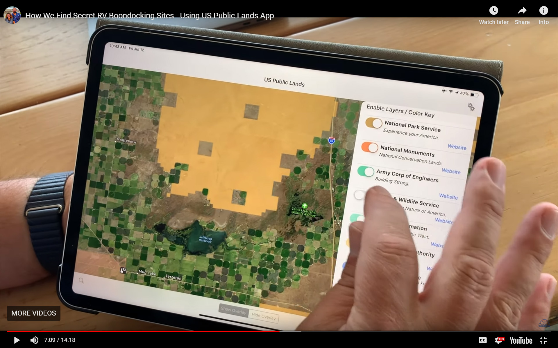
US Public Lands app on an iPAD, showing PAD-US data
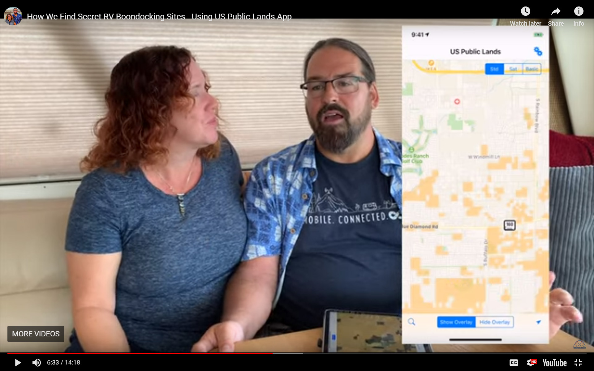
Cherie and Chris of Technomadia.com talking about value of new PAD-US 2 data for their app
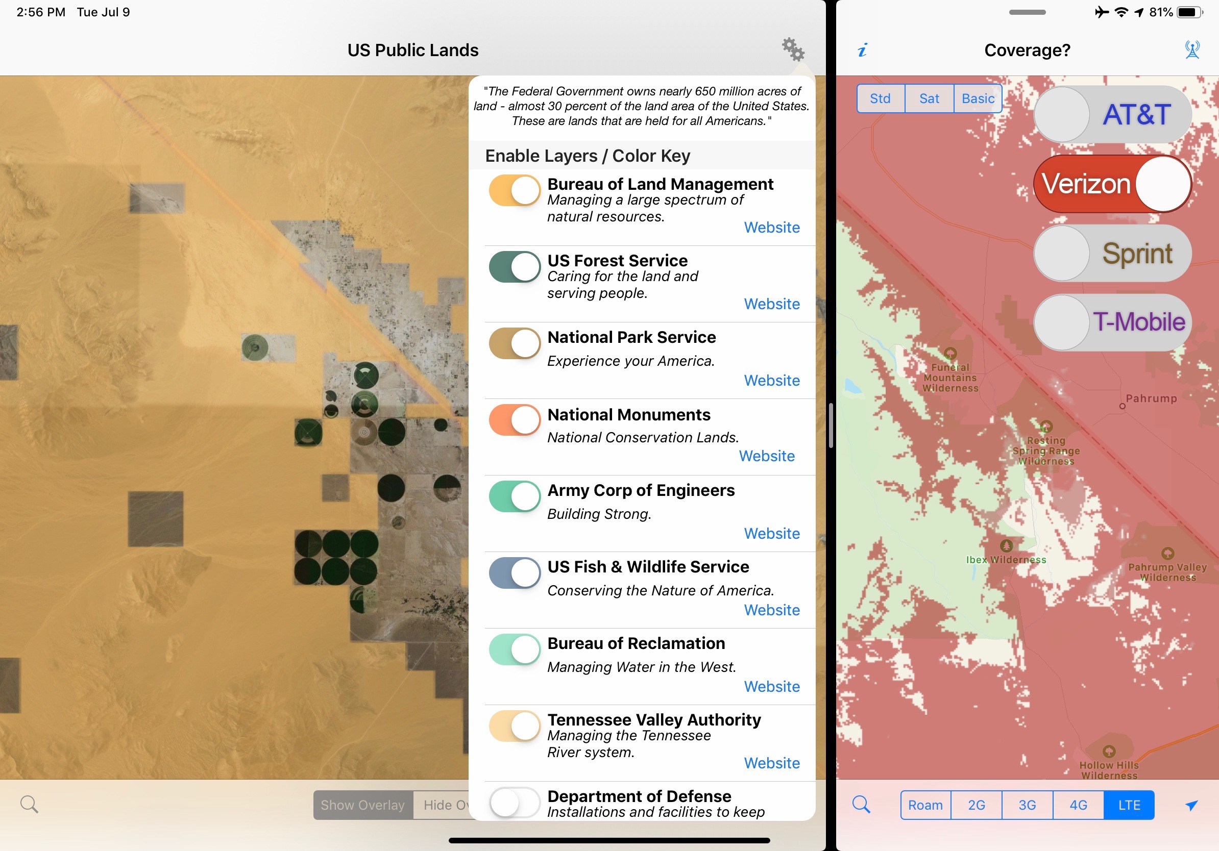
The US Public Lands app allows choosing which agency layers to browse for camping opportunities.