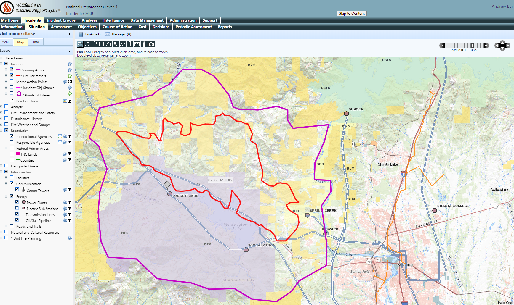
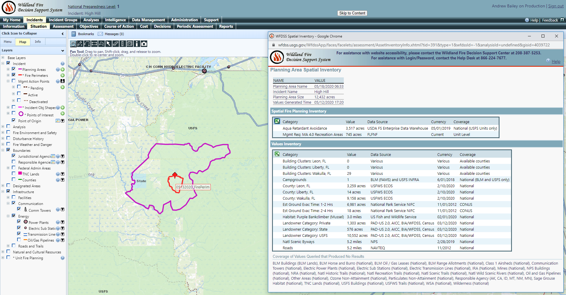
The National Wildfire Coordinating Group relies on the Protected Areas Database of the United States (PAD-US) geodatabase for land management and designated area boundaries in analyses for decision-making related to wildland fires, particularly in the Western United States. Andrew Bailey, lead for the National Wildfire Coordinating Group and member of the USGS-led FGDC Federal Lands Working Group, says, “PAD-US is a powerful tool and now has much MORE information available. Being able to use one data source that handles surface management jurisdiction and designations, and is transparent back to the original data sources, is tremendously important for the wildland fire community.” PAD-US supports the Integrated Reporting of Wildland-Fire Information (IRWIN) Service and Wildland Fire Decision Support System.