A Resource for the Protected Areas Database of the United States (PAD-US)

Monthly Archives: July, 2019

New PAD-US Help System is Online!

As part of the announcement of PAD-US 2.0, a new online help system for PAD-US has gone live on ProtectedLands.net!

This new help system covers a wide range of topics, from a short introduction to PAD-US to extensive details about how the data set works. GreenInfo Network developed the Word Press application for the Help and the initial information presented, while USGS PAD-US staff added to and refined the information.

The new PAD-US Help system will evolve as requests and comments come in and as the data changes.

Image of help system web site

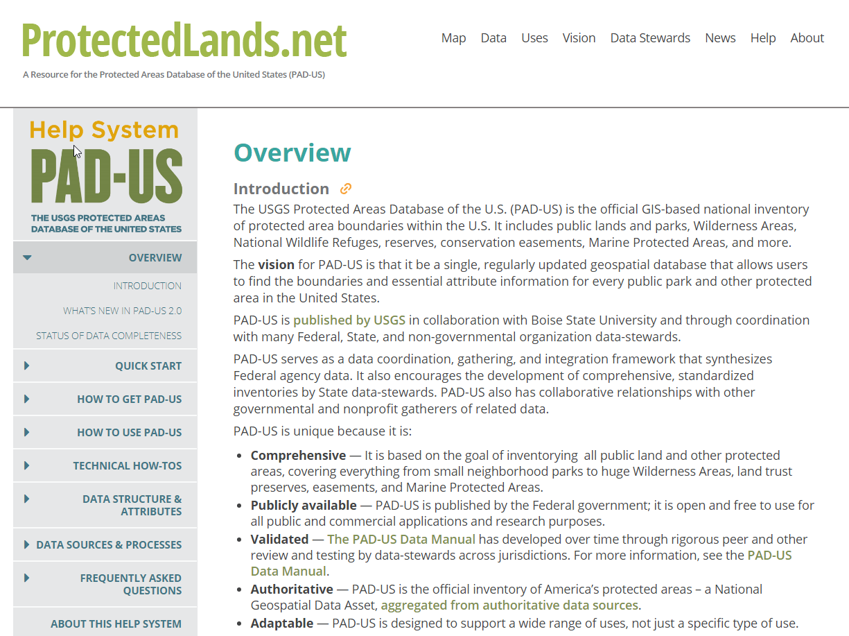
PAD-US Help system home page


Image of Help system web page

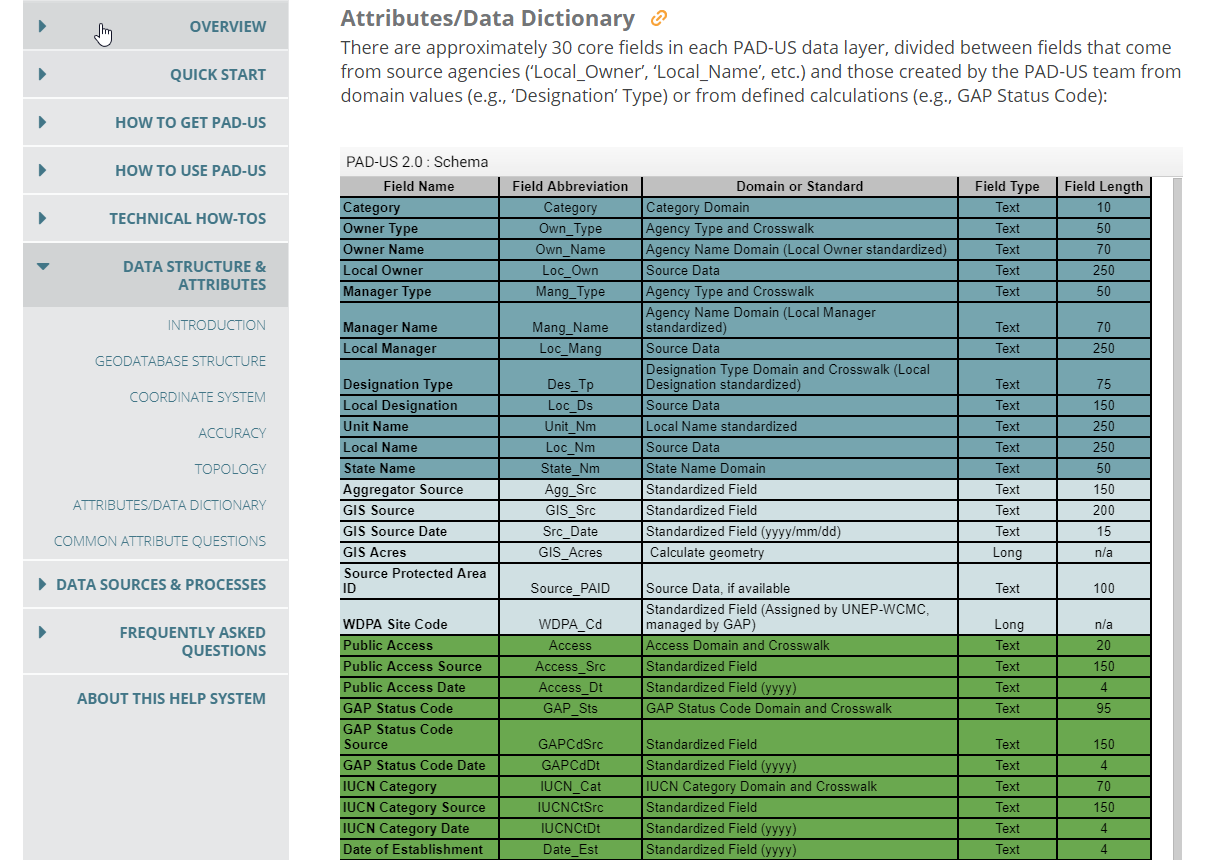
PAD-US attribute table in Help system.

Read more

PAD-US 2.0 Release Announced

Version 2.0 of the Protected Areas Database of the U.S. (PAD-US) has been announced as of July 9, 2019.  The new data has major federal, state and easement updates, an easier-to-use data structure, new web services, national-scale printable maps, and more.

More information is in the USGS Technical Announcement, which details data improvements as well as new web services available:

  • Changes to the structure of the GIS database to make it easier to use, particularly the separation of feature classes for fee ownership from policy-designated areas (wilderness, national monuments, etc.), plus continuation of layers for easements and marine protected areas.
  • A new, separate layer for proclamation and other boundaries that outline forest, park or refuge areas approved for voluntary acquisition and military lands without internal ownership defined.
  • Improved boundary line geometry with far fewer overlaps and slivers, particularly among federal fee agency lands.
  • Greater consistency and completeness in PAD-US attributes (naming, access, and more).
  • New agency reports for data steward contacts and source data links, available soon from the USGS. Current access.
  • Updated data from most federal land management agencies (including NPS, USFS, USFWS, BOEM, NOAA and BLM), developed through the Federal Lands Working Group.
  • Major updates to more than 30 states, including 12 from the PAD-US State Data-Steward Network (California, Georgia, Iowa, Idaho, Minnesota, Missouri, New Jersey, New York, Oregon, Tennessee, Virginia and West Virginia).
  • The integration of nonprofit databases which updated many more states (The Nature Conservancy Fee Lands and Secured Lands aggregation, The Trust for Public Land Conservation Almanac, Ducks Unlimited Conservation and Recreation Lands). More information
  • The latest easement data from the National Conservation Easement Database.
  • A ready-to-use downloadable statistics table, summarizing PAD-US 1.4 attributes (PAD-US 2.0 update coming soon) by state and for the nation.
  • The ability to print map files at any size–including poster size – with four national themes and the states coming soon.
  • Updated WMS services for pulling in different views of PAD-US data to applications and desktop GIS sessions.
  • history of PAD-US and a vision for the future of the database. These plans propose the goal of a complete PAD-US by 2020. Currently, approximately 95% of federal lands and waters are included in PAD-US, while only about 60% of state, regional and local park and other preserve lands are in the database. Through the work of the Trust for Public Land’s Park Serve program, great improvements in urban parks data will occur in the next release of PAD-US.


Read more

New National and State PAD-US 2.0 Poster Maps

You can now access digital files for PAD-US 2.0 poster maps on the USGS PAD-US web site – use them in presentations, or print your own versions at almost size.

These custom maps for PAD-US were developed by GreenInfo Network and are available by Manager Name (specific federal agencies, generalized names for state/local agencies), Federal Manager Name (federal lands only), Public Access (whether open or not), and GAP Status (degree of biodiversity protection).

For PAD-US 2.0, new maps are also available for every state.

Provided files include smaller JPGs for presentations and simple uses, and larger PDF files for printing up to 30″x40″ sizes.

Example of a PAD-US National map (Manager Name):

national map


Example of State map:

state map


Read more