A Resource for the Protected Areas Database of the United States (PAD-US)

Uses

Energy Corridor Mapping with PAD-US

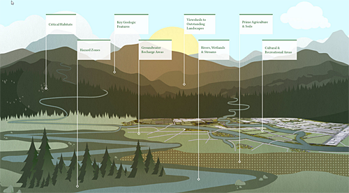
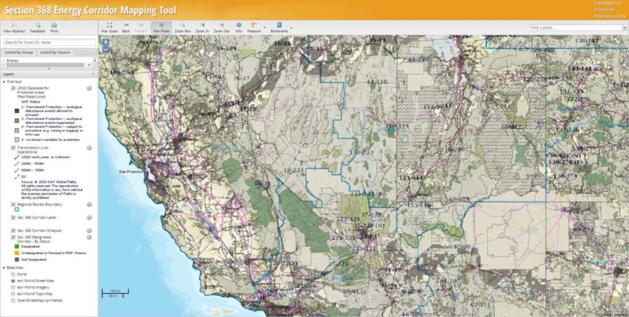
The Section 368 Energy Corridor Mapping Tool, developed for the Bureau of Land Management (BLM), Department of Energy (DOE), and the U.S. Forest Service (USFS) uses PAD-US data to show protected areas by GAP Status Code (a measure of biodiversity…

Read more

PAD-US 2.0 Helps RV Users Find Great Campsites

RV in public land

Taking a Recreational Vehicle out to find a great campsite is an avocation for hundreds of thousands of people in the U.S.  One couple has been on the road in their RV for years and has published a app to help find these sites on public lands – PAD-US 2.0 has given them and their app a huge boost in quality.

Read more

Green Infrastructure and PAD-US

greeninfrastructure illustration

Communities across the U.S. and the world are working to preserve and connect open space, wildlife habitats, parks and other important landscapes, as part of planning for Green Infrastructure. “The USGS Gap Analysis Project (GAP) has a long history of…

Read more